
Visor's airborne synthetic aperture radar (SAR) products are designed to provide high quality data for scientific and commercial applications.
VISOR TERRAIN MAPPING RADAR
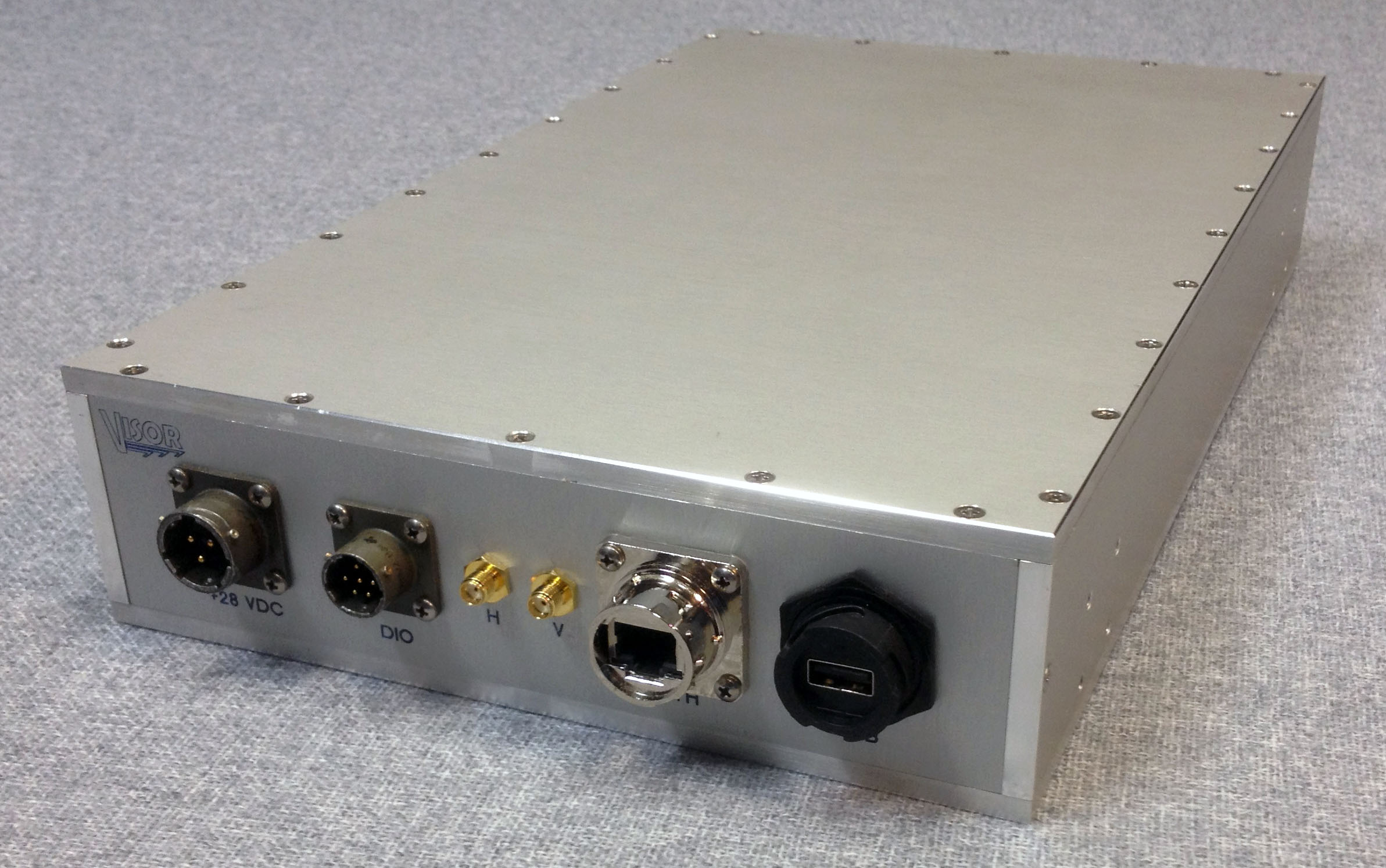
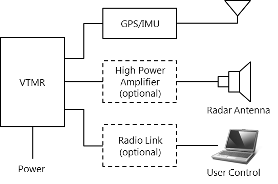
Visor's Terrain Mapping Radar (VTMR) is a miniature, multi-band SAR designed for small aircraft applications. It provides high quality data for terrain mapping in all weather conditions. It includes ControlScope control software that provides a Windows-based graphical user interface through which remote users can control, collect, display, and record signal data from a remote PC. It also includes MPSI, a fully-featured ground control software with an intuitive graphical interface.
Three Frequency Options
The L-Band system provides high-resolution imagery in a package that is easily mounted on small aircraft. It is ideal for terrain mapping and for assessing damage to man-made structures caused by natural disasters.
The X-Band system offers precision detection of small objects from large standoff distances. It operates at the frequencies commonly used for general purpose terrain and ice mapping.
The P-band system is ideal for applications that require foliage or ground penetration in dry soil conditions.

Applications
Land
Terrain mapping and classification
Surveillance and change detection
Pipeline and power line routing
Water
Coastal mapping
Ship detection
Fishing enforcement
Agriculture
Crop and soil monitoring
Timber management